McLeod Ganj sits on a ridge above Dharamshala, under the Dhauladhar range, at about 2,082 metres according to Wikipedia. It is best known as the home of the Tibetan government-in-exile and the Dalai Lama’s temple, but it is also a walking town: cafes, monasteries, forest paths and one of Himachal’s best-known day treks all start within a short distance of each other. This guide sets out the places most visitors want to see, how to sequence them, and what to check before you go.
The temple complex and the Tibetan quarter
The centre of the town is the Tsuglag Khang, the temple complex associated with the Dalai Lama. Wikipedia’s entry on McLeod Ganj notes that it houses statues of Shakyamuni, Avalokiteshvara and Padmasambhava. The nearby Namgyal Monastery was established with the government-in-exile in 1960, and the Library of Tibetan Works and Archives, opened in 1970, is described as an important institution for Tibetology.
These are working religious and cultural sites. Dress modestly, remove shoes where asked, keep your voice low, and ask before photographing people or prayer rooms. Security checks at the entrance are common. Opening hours and any special teaching or event days change, so check locally.
Bhagsu: temple and waterfall
Bhagsu is a short distance from the main square and has a temple dedicated to Bhagsu Nath (Shiva), plus a waterfall of roughly 20 metres. The walk from the temple to the falls is short but steep in places. Water volume depends heavily on season: it tends to be fuller during and after the monsoon and thinner in the dry months, so the experience varies.
Triund: the day trek everyone asks about
Triund is a meadow at roughly 2,800 to 2,900 metres. Per Wikipedia’s Triund entry, trekkers can walk or drive from McLeod Ganj to the Galu temple above Dharamkot and follow a marked trail. Most of the trail rises gradually, but the final section is steep, with a number of zigzags. We do not quote trek times here because they depend on fitness, season and where you start; ask locally and start early so you are descending before late afternoon.
- Check recent trail conditions and any local rules or permits before setting out, especially after rain or snow.
- Carry water, a rain layer, a torch and snacks; the weather can shift quickly.
- Wear shoes with grip. Trainers with worn soles are the usual cause of slips.
- If you want to camp, confirm current rules with local authorities; we have not verified them.
Smaller things worth your time
- Short forest walks: The pine and deodar slopes above the town have paths of different lengths. A gentle walk is a good first-day activity while you adjust to the altitude.
- The cable car: Wikipedia reports a 1.8 km cable car between Dharamshala and McLeod Ganj, inaugurated in 2022. Check whether it is running on your dates.
- Parks and viewpoints: Our hotel listing names Sangam Park (2.6 km), Nehru Smriti Vatika (3.3 km), and Sahid Smarak and Sher Jung Thapa parks (5 km each).
- Cricket: The HPCA Stadium is listed at about 6 km from our hotel.
Seasons: what to expect
The big variable is the monsoon. Wikipedia’s Dharamshala entry describes the monsoon as running from June to mid-September with up to 3,000 mm of rain, which makes the area one of the wettest in the state, with July and August the peak. Winter, from December to late February, can bring snow and sleet to upper Dharamshala including McLeod Ganj, Bhagsu and Naddi. Autumn is described as mild, with average temperatures of around 16 to 17 degrees Celsius from October to late November. Summers can be hot at lower elevations.
The practical reading: if you are planning to trek or want clear mountain views, the dry months before and after the monsoon are the safer bet; if you want snow, winter offers a chance but never a guarantee; and in July and August you should plan for rain, slow roads and the possibility that outdoor plans change. Our wider seasons guide covers this in more detail.
How to get to McLeod Ganj
- By air: Kangra (Gaggal) airport is about 12 km south of the town, per Wikipedia. Check current flight availability.
- By rail: Pathankot is about 90 km away and is the nearest major railhead. The Kangra Valley Railway’s nearest station is Chamunda Marg, about 22 km away.
- By road: Overnight buses and taxis connect Dharamshala and McLeod Ganj to Delhi, Chandigarh and Pathankot. Mountain roads are slower than distance suggests.
A three-day outline
Day 1: Settle in, walk through the main square, and visit the temple complex and Tibetan quarter in the afternoon.
Day 2: Bhagsu in the morning, then a lighter afternoon: a cafe, a museum or a short forest walk.
Day 3: Triund, starting early, with the afternoon free for rest.
Staying nearby: our hotel
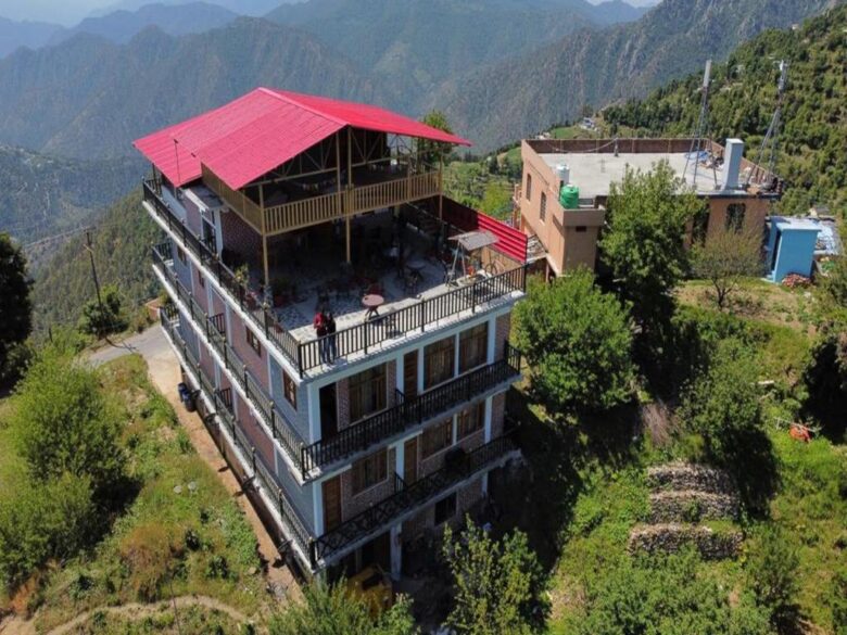
Disclosure: LA Riqueza Hotels publishes this blog and runs LA Riqueza Koala Inn, our hotel on Jogiwara Road in McLeod Ganj. Its listing describes a newly built property with a rooftop terrace, an in-house restaurant with Himachali dishes and global cuisines, free private parking (reservation needed), an elevator, a 24-hour front desk and a tour desk to help plan excursions. Free pick-up from the bus stand and airport is offered for stays of at least three nights. Room types run from a dormitory bed to a family room. See the gallery for photos, or contact us with questions.
Frequently asked questions
Is McLeod Ganj the same as Dharamshala?
McLeod Ganj is a suburb of Dharamshala, higher up the ridge. Lower Dharamshala is the administrative town.
Do I need a guide for Triund?
The trail is well-trodden, but conditions change. A local guide can help in poor weather or if you are unsure of the route.
Is it cold in winter?
Yes, and upper Dharamshala can see snow. Pack warm layers and confirm heating at your accommodation.
For official regional information, see Himachal Pradesh Tourism.
Disclosure: this article is published by LA Riqueza Hotels, which operates the hotels marked "our hotel". Facts are compiled from the public sources linked in the text and from our hotel listings. Opening times, fees, road and weather conditions change, so check locally before you travel.
Keep reading
Kufri Travel Guide: Sights, Seasons and a Two-Night Plan
What Kufri is like, how its sights fit together, when snow is realistic and how to reach it from Shimla, Delhi or Chandigarh.
Read article
Dhanaulti Weekend Guide: Eco-Parks, Surkanda Devi, Weather
A slow two-night plan for Dhanaulti: eco-parks, forest walks, the Surkanda Devi temple and honest notes on weather.
Read article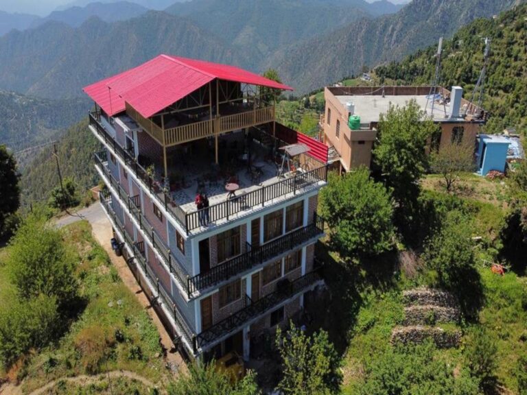
Kanatal Travel Guide: Surkanda Devi, Tehri Dam and Stays
A slow-paced Kanatal guide with day trips to Surkanda Devi, Tehri Dam and Dhanaulti, plus road and weather notes.
Read article